 В Атырау
+21
В Атырау
+21
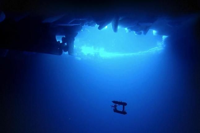 Underwater robot mapping sea ice. (Woods Hole Oceanographic Institution)Scientists have now used an underwater robot to create 3D images of Antarctic sea ice.
Scientists previously used satellite data, holes drilled into the ice and visual observations to determine the thickness of sea ice in the Antarctic, but being able to also see sea ice from below with an underwater robot creates a fuller picture. A team consisting of researchers from the United States, the UK and Australia were able to achieve just that.
Collecting data in 2010 and 2012, the scientists used the Autonomous Underwater Vehicle named SeaBED at three locations in the Antarctic, and they were able to determine ice thickness in those areas. The robot is roughly 6.5 feet long and almost 450 lbs, and it uses sonar to map the ice, upi.com reports.
They found ice as thick as 55 feet in some areas. There is still a lot more sea ice to measure, but the researchers see this as an important step toward achieving that. Measuring sea ice is important to understanding the changing climate.
"What this effort does is show that observations from AUVs under the ice are possible and there is a very rich data set that you can get from them," said Ted Maksym, a Woods Hole Oceanographic Institute scientist and a co-author of the paper. "This work is an important step toward making the kinds of routine measurements we need in order to really monitor and understand what's happening with the ice and the large scale changes that are occurring."
 Send your news to AqZhaiyq